
Season 2 registrations are open — Chennai · 28 August 2026 and Coimbatore · 25 September 2026.

Register Your Team

Sustainable Development Goal 11 / 17

Sustainable Cities and Communities

Make cities and human settlements inclusive, safe, resilient and sustainable. For builders: tools that make urban systems — waste, mobility, housing, civic response — visible and answerable to residents.
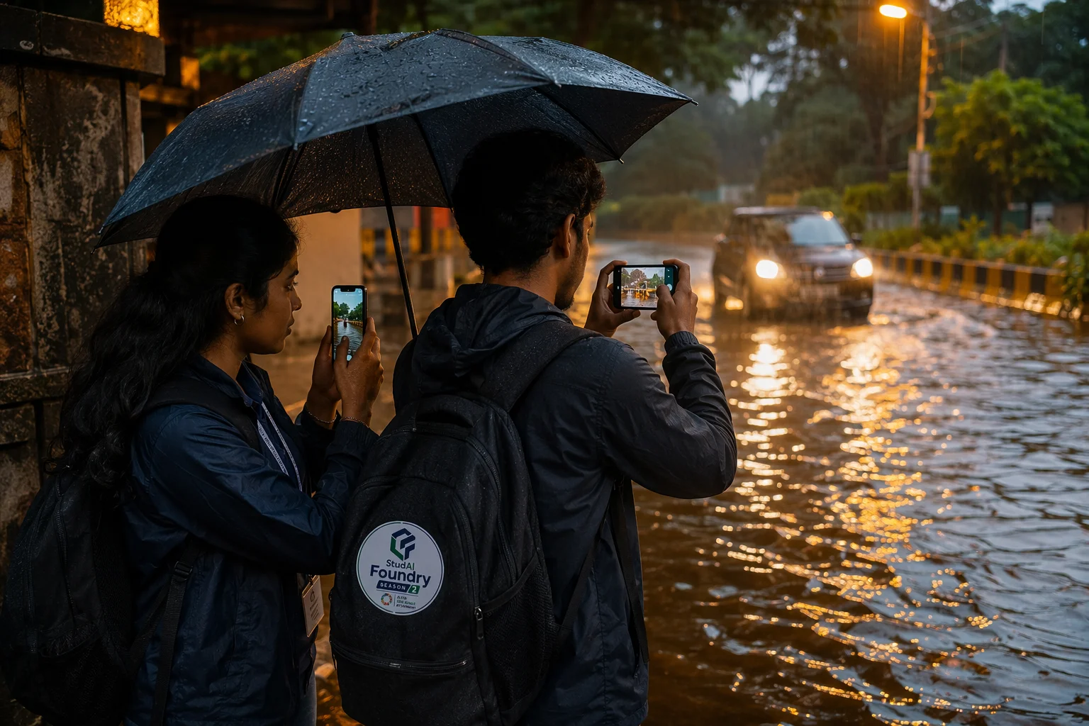
Residents photographing a flooded street corner to report it.

Why this goal matters

Cities are where most SDG problems concentrate and where most data already exists — buses have GPS, complaints have records, wards have boundaries. Yet residents experience cities as opaque: garbage disappears or does not, buses arrive or do not, floods come with no warning. Closing the loop between city data and city residents is a rich, buildable space.

The Indian context

India is urbanising at historic scale, with hundreds of millions more city dwellers expected in the coming decades. The Smart Cities Mission built data infrastructure in a hundred cities; the unfinished work is turning that infrastructure into everyday resident value — reliable services, flood resilience, safe streets and honest grievance systems.

Tamil Nadu, specifically

Tamil Nadu is one of India’s most urbanised large states. Chennai lives an annual cycle of flood risk and water stress with an active civic-tech and open-data community. Coimbatore, a Smart Cities Mission city, pairs an industrial economy with growing mobility and waste pressures. Both cities have functioning complaint systems that better software could make dramatically more effective.

People and communities affected

  • Residents of flood-prone and low-lying neighbourhoods
  • Public-transport-dependent commuters
  • Informal-settlement households facing service gaps
  • Sanitation and conservancy workers
  • Street vendors navigating urban regulation

Key challenge areas

  • Flood early warning and neighbourhood resilience
  • Waste segregation, collection and accountability
  • Public-transport reliability and last-mile access
  • Grievance-redressal effectiveness
  • Heat-island and green-cover monitoring

The AI Lens

Where AI belongs here — and where it does not.

Where AI can meaningfully help

  • Hyper-local flood alerts fusing rainfall, drain and terrain data with resident reports
  • Image-verified waste-collection accountability from geo-tagged photos
  • Bus-arrival prediction that handles Indian traffic reality honestly
  • Classifying and routing civic complaints to the right department with escalation tracking

Where AI may be inappropriate

  • Facial-recognition surveillance framed as “smart city safety”
  • Predictive policing of neighbourhoods
  • Eviction-supporting analytics against informal settlements

Build Directions

Example problem directions

Starting points, not prescriptions — the strongest submissions narrow one of these into a specific, evidenced local problem.

Direction 01

A ward-level flood companion for Chennai: street-level risk from open terrain data plus crowd reports, with reduced-data mode for storms

Direction 02

A waste-loop tracker: residents photograph collection points, the system verifies clearance and surfaces chronic gaps

Direction 03

A bus-reliability app for Coimbatore that learns real route behaviour and tells commuters the truth

Direction 04

A complaint-outcome observatory that measures which grievances actually get resolved, by ward

Potential users

  • Residents and welfare associations
  • Municipal operations teams
  • Commuters
  • Civic-tech and open-data communities

Possible datasets

  • OpenStreetMap and open terrain/elevation data
  • IMD rainfall and cyclone warnings (public)
  • Published municipal complaint statistics and open-data portals
  • GTFS transit feeds where available; your own crowdsourced pilot data

Data-access limitations

  • Drain and stormwater network maps are rarely public or current
  • Complaint data undercounts those who gave up reporting
  • Crowdsourced data needs verification design against noise and abuse

Privacy, bias and safety risks

  • False flood alarms erode the trust that real alarms depend on
  • Accountability tools can be gamed by staged photos — verification matters
  • Publishing granular risk maps can affect insurance and property fairness; aggregate responsibly

Responsible-AI considerations

  • Design alerts with graded confidence and clear guidance on action
  • Coordinate with — not against — municipal systems for anything safety-related
  • Protect reporter identity by default

Suggested impact metrics

  • Alert lead time and precision/recall against actual flood events in pilot wards
  • Verified improvement in collection or resolution rates where the tool is active
  • Prediction accuracy versus published schedules for transit pilots

Build for Sustainable Cities and Communities.

Anchor your team in this goal, define one real problem, and start the three-lock journey.

Register Your Team